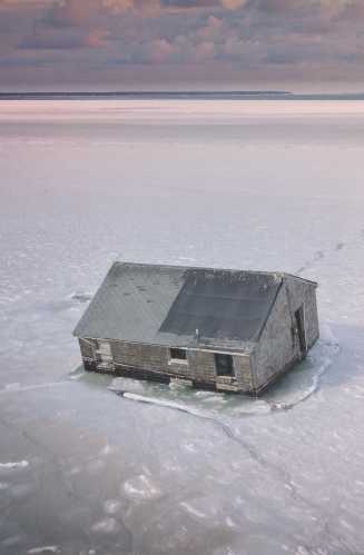
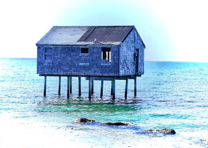
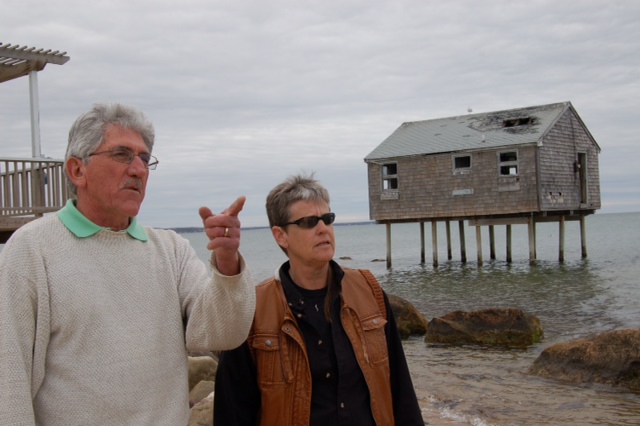
A much-photographed house that sat above the water off the end of Mulford Lane on Napeague’s Lazy Point toppled into iced-over Gardiner’s Bay, its wooden stilts snapping over the weekend during this long winter cold spell.
The weathered beach shack had once been a home, but had been abandoned as Lazy Point’s northern shoreline eroded. Fully surrounded by water since about 2004, it became an attraction for locals and tourists alike, who captured the house in various seasons and light, all amazed that the pilings continued to stand.
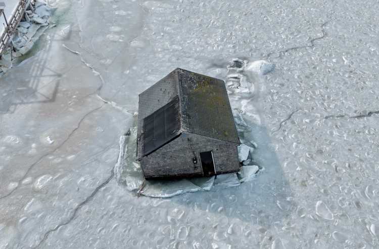
That came to an end on Saturday night when the stilts collapsed and the shingled structure hit the icy top layer of the harbor, becoming partially submerged. Drone photography from Tim Tierney’s SkyHamptonAerial shows large cracks splintering the ice as the house sank.
What happens now? We understand the town officials are weighing its options for clean-up. But the question will come down to real estate — who owns the bottom land there?
Jim Grimes, the deputy town clerk for the East Hampton Town Trustees, an elected governing body responsible for managing and protecting the town’s public trust lands, including beaches, bay bottoms, and underwater property, with authority that predates the town board, tells Behind The Hedges Monday morning that it is not one of the areas the trustees lay claim to.
“For many years, people thought that that was trustee beach down there — it is not. Unfortunately, like some other waterfront properties, when the trustees sold that land, they sold it to the mean-high watermark. So it’s not trustee-bottom, and it wouldn’t be anyway because once that house, basically the property, became submerged, it doesn’t exist anymore. You lose your property into the water, it’s no longer intertidal; it’s underwater all the time.”
He thinks that part of the bottom land probably belongs to the state, though the Town of East Hampton may have “some jurisdictional attachment there,” he adds.
According to Grimes, the person who owned the house was, at one point, trying to sell some part of either the property or the house to the town. “The town just had no interest — for good reason. It’s just a liability. [The property] was already underwater, so I don’t know who is going to be responsible for the cleanup,” he says, adding, “The people that owned the house, I think, still kind of maintained the view that they owned it. I wonder if they still have that view. I’m kind of gonna doubt that they do.”
The ice is keeping the structure somewhat intact and in place — at least for the time being.
Patrick Derenze, the public information officer for the town, said on Monday afternoon that the town has been in contact with the owner, who is listed in public records as Gary Ryan of New York City, though he declined to confirm the name. The town has also been in touch with the New York State Department of Environmental Conservation and the U.S. Coast Guard and has determined that at this time it is not considered a navigational hazard as it is encased in ice.
“As temperatures warm up, it is possible the building will no longer be stuck where it is,” Derenze says, but a plan of how it will be removed from the water is still being determined.
It would be the owner’s responsibility to clean up the wreckage, but if it poses a risk to the public, the town could step in, Dereneze adds.
“Right now, until that ice breaks up, I don’t think there’s too much urgency here,” says Grimes. “But once that ice breaks up, I think that’s going to change. Depending on what the wind direction and what tides we have — like right now, is an extremely high tide down there in Gardiner’s Bay — the whole meadow is flooded with this full moon. When the ice breaks up and we get a similar situation or you get a northeast wind, it’s going to start to push that thing around,” Grimes says.
“I was amazed at how far out it has frozen. It’s pretty wild looking. I haven’t seen that in years.”
Property along Mulford Lane, a paved private road that dead-ends on the bay, has suffered major erosion over an extended period of time, with coastal flooding during storms that has caused destruction to the road, decks, cars and homes. Many of the homes have been raised to combat the damage the coastal flooding would wreak on their homes.
In 2014, the Town of East Hampton was awarded $9.9 million in federal grants to acquire 16 flood and erosion-prone properties on Mulford Lane and the adjacent Bay View Avenue, in the hopes of creating a protective buffer for future storm damage.
Some of the 16 properties were developed and some were not.
The grant, which was awarded through the federal Emergency Watershed Protection Program, will be used to purchase approximately 16 properties on Mulford Lane and Bay View Avenue—some vacant, some developed—from eligible property owners who have expressed interest in the program. Improvements to the parcels will be razed, and the land will be restored to its original and pristine condition to better serve as a floodplain and storm buffer.
This article was updated at 2:30 p.m. on Feb. 2.
Email tvecsey@danspapers.com with comments, questions, or tips. Follow Behind The Hedges on Facebook, X and Instagram.